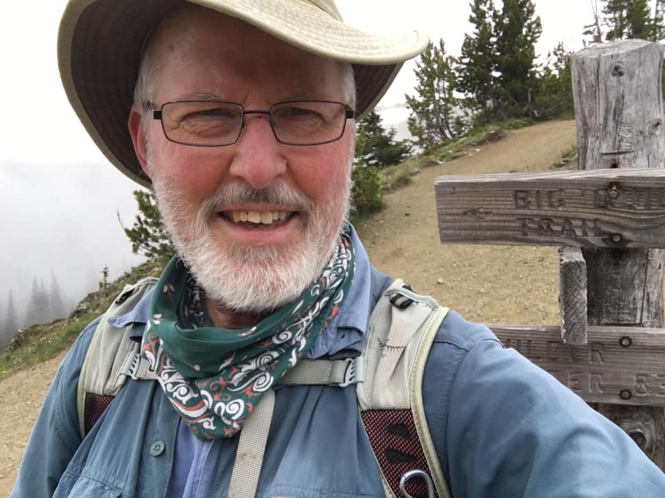
I love to go a-wandering off the beaten track,
and as I go, I love to sing, my knapsack on my back.
Val-di-ree, Val-di-rah,
Val-di-ree, Val-di-rah-ha-ha-ha-ha-ha-ha
Val-di-ree, Val-di-rah,
My knapsack on my back.

Monday, August 3, 2020

Sundown Pass from South Fork Skokomish River, August 3, 2020

South Fork Skokomish River to Sundown Pass and Sundown Lake
14.4 miles and 3,100 feet elevation gain

On Sunday, August 2, I drove up the South Fork Skokomish River to the upper trailhead. The lower part of the valley is quite lovely with small farms beneath the scraggly timbered hillsides. There were a lot of local people swimming and picnicking on the Skokomish River gravel bars. Arrived at the trailhead at 6:00 pm. Explored a little, heated up some canned beef stew and started hiking at 6:30.

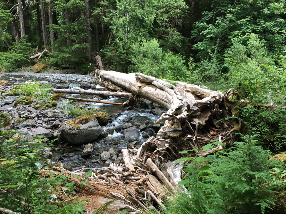
I traveled light, taking only my red day pack, a sleeping bag, tarp, and sleeping pad. No stove or cooking gear. The first part of the trail is an old road so it’s easy going. Then the trail crosses the river on a huge cedar tree that blew down in just the right place for a foot log. 

Foot log across the Skokomish River

The trail parallels the river, gaining elevation gradually as it winds through big firs. It was a quite pleasant walk in the late evening. Arrived at the next river crossing at 7:40 and made camp after crossing the river on the rocks. The mosquitoes dive-bombed me until after sunset when it began it cool down.
 
My camp along the Skokomish River
 
Had cold cereal for breakfast the next morning and started up the trail at 6:40 am. I left my sleeping bag, pad, and tarp at the campsite. It was cloudy the whole day but there was no rain. The first part of the trail was well made and maintained, but after crossing into the Park, the the trail deteriorated into a rough path. Near the pass, it was steep and the footing was poor. 
 
The lower trail

At the pass

Made it to Sundown Pass at 10:20 and to Sundown Lake at 10:40. I was here two weeks ago but I couldn’t see the lake for the fog that day. Today I had a good view of the lake and the basin. Rested briefly and began the return trip.
 
Harebells and other flowers just below the pass.

Sundown Lake
 
Went back over Sundown Pass and started down the other side. Had lunch at a campsite near one of the meadows and kept going. 


Looking down the Skokomish valley


A tarn just below the pass
 
Picked up my gear where I left it at the campsite by the river and hiked the last two miles out. My feet were sore from all the pounding, but I made it to the car by 3:40 pm, just as the clouds began to break and let the sun through a bit. Drove home without stopping so I could make it for supper.


Wednesday, July 29, 2020

Little Divide Hike July 28, 2020

From the Sol Duc Hot Springs trailhead to Mink Lake, up to Little Divide, along the divide to Deer Lake, down to Sol Duc Falls, the along Lovers Lane trail to the car at the trailhead. 14.0 miles, 2,400 feet elevation gain.

I left work about 4:00 on Monday afternoon and drove to Sol Duc. After stopping at Fairholme campground and seeing it was full, I drove to Sol Duc Hot Springs and looked for a place to sleep that would be out of the way of the park rangers. I walked down Lovers Lane trail about five minutes and found a perfect place near the river, just off the trail. Returned to the car, drove to the Sol Duc Falls trailhead where I sat at a picnic table and had dinner. Lots of people come out from the trail. About 8:30 I drove back to the Hot Springs, parked, and took my sleeping bag and big foam mattress to my camping spot. Slept well. Woke up in the night to see the stars peeking through the vine maple leaves just above me.

Got up, walked back to the car and set up the Coleman stove behind the car and made breakfast. Coffee and granola. Started up the trail at 7:15 am. It felt pretty good to go up the switchbacks in the cool air. Made it to Mink Lake at 9:00. Stopped at the shelter, met to talkative young women who were planning to hike up to Little Divide, down to Deer Lake, and up to Lunch Lake. Hope they got started soon after I left. That's a stiff hike.

Mink Lake
Mink Lake

Kept on going up to the divide. The trail goes up but not too steeply and I still felt fairly fresh. Made it to the junction at 10:25. Started in an easterly direction along the divide between the Sol Doc valley and the Bogachiel watershed. Really a lovely trail along the ridgetop or traversing slightly below the ridge. There was a cool breeze blowing from the Bogachiel valley that kept the mosquitoes off. The tread of the trail was soft and easy. Not many people hike this trail.

Little Divide trail

At 12:00 I arrived at the place where the trail drops over the ridge and starts down. Stopped for a leisurely 30-minute lunch with the breeze coming through the gap. Took my boots off, laid down in the sun, and rested.

At lunch

Started off again, down to Deer Lake. Arrived at 1:15. Lots of people, including families. I could hear their voices across the lake.

Deer Lake

Started down the trail below the lake. It's a terrible trail, quite eroded and full of rocks and boulders.


By this time my feet were starting to hurt. My boots are wonderfully supportive but after eight miles my feet hurt anyway. Passed lots of people coming up to Deer Lake, including a group of eight young women. I had my mask around my ears and tucked under my chin. When I saw anyone approaching, I pulled it up until they passed. A lot of people would guiltily raise their mask when they saw me or turn away from me and cover their mouth and nose.

Mask at the ready


Sol Duc Falls

Got to the Lovers Lane trail junction at 3:15, took a break to rest my feet. Made a quick detour to photograph the Sol Duc falls, then started on the Lovers Lane trail back to the car. It was pretty flat, easy going, but I was tired and my feet were in pain. Slogged along trying to appreciate the towering douglas fir trees and tall ferns. Made it back to the car at 4:15, took off my boots and rubbed my poor feet before putting on softer shoes.

Drove home, stopping at the Starbucks drive-through in Sequim for coffee and a cheese danish. Boy, was it good.

Friday, July 17, 2020

Sundown Lake, July 17, 2020

Hiked up over Wynoochee Pass, down to Graves Creek, then up to Sundown Lake. Returned the same way.

Wrapped up things early at work on Thursday afternoon and left directly at 4:00 pm. Drove through Shelton, then continued west on County roads which gradually got smaller and rougher. Ended up on a gravel road with a rough surface, wondering, why did Google tell me to go this way? But after a short ways it intersected with the smooth asphalt highway up the Wynoochee River from Montesano.

Drove up to the Wynoochee Dam and took a side road to check out the Forest Service campground (full) and the dam. Continued on the road up the river which turned into gravel. I kept looking for a camping spot on the side of the road, but every available pullout was crammed with campers. Finally at Wynoochee Falls I found a wide place in the road and set up my tent on the gravel. Not the best place, but it sufficed.

Made dinner (canned stew heated up on the Coleman stove) and walked down to the falls. Pretty.

Wynoochee Falls

I was up about 6:15, made breakfast and packed up. Drove to the trailhead on rather rough logging roads and started hiking by 8:00. The trailhead is on an old logging road on a steep hillside. When I looked back at the lower Wynoochee valley, I could see the fog laying in the valley, but it was sunny at the trailhead.
The Wynoochee Valley in the morning

The trail started with a half mile on the logging road, then plunged into old growth forest. It was a lovely trail, sidehilling around to the left, gradually climbing. It felt good to be hiking with fresh legs and comfortable feet. The trail crossed a few streams, then turned to the east as it climbed up to the pass, Somewhere in there the clouds covered everything and it became foggy and damp. When I reached the pass at 10:00, the brush was soaked and I was wet from the waist down.
Tarn at Wynoochee Pass

There was a couple of tarns at the top of the pass with some pretty pink flowers I wasn't familiar with. Started down the other side with a bg switchback and along traverse down to the creek. I was thikning, maybe I should just turn around at the creek. Won't be able to see much at the lake anyway. But I met a hiker just coming up from the creek. He said he'd come from Sundown Lake. "You ought to go see it," he said. "It's not that far." So I decided I might do that.

Took a break at the creek at 11:00, then I decided I would hike until noon and decide whether I would go to the lake or not. It was gloomy and dark in the big timber, with fog on the hillside. By noon I was near the top of the switchbacks to the lake, so I decided to keep going. It was a steep climb up to the lake, then it leveled out as the trail traversed over to the intersection with the South Fork Skokomish trail.
Fog near Sundown Lake

A little bit further, and I came to the lake, although I couldn't see it at first. The fog was laying right on the water, and it all looked the same.
Sundown Lake

Sat down and ate lunch, but it was too cold for a long break so I started back after about 15 minutes. Went down the switchbacks and arrived at Graves Creek at1:30. By this time I was getting a little tired. Climbed back up the trail to Wynoochee Pass, took a break, then hiked slowly down the trail to the car. I was tired and my feet hurt.

Arrived at the car  at 4:30 pm with the clouds clearing away and a nice view from the logging road.

Saturday, July 11, 2020

Wagonwheel Lake and Cub Peak July 10, 2020

Woke up about 5:30 and went to Starbucks to pick up a coffee and breakfast wrap and started driving about 5:50. Arrived at Staircase Trailhead at 7:20 and was hiking by 7:30.

It was cool and overcast when I started up the switchbacks. The sign at the trailhead said, “2.9 miles, Very Steep.” Actually I didn’t think it was that bad. The trail was steep but the tread was good and I made my way slowly up the ridge, stopping every 30 minutes for a breather. I felt really good. My feet were comfortable in my boots, my legs felt good, and my heart and lungs were pumping away. When the endorphins get going, it feels great.

About 10:30 the trail began to level off, I crossed an avalanche chute with lots of slide alder and arrived at the lake at 11:00. There wasn’t much to see because trees and brush crowd the lake. I took a 20 minute break and continued up the boot path to Cub Peak. On the way up I met a man coming down who said that the views from the peak made the hike worthwhile. 

The boot path was a scramble in many places, requiring handholds from nearby brush and tree limbs. I could feel my left ankle starting to hurt and my left foot felt weak. It was about 500 feet elevation gain and I made it to the top, quite tired, right at 12:00. I sat down on the heather and moss and had a good break and ate lunch. I was there for 45 minutes enjoying the view and resting. 
The clouds that were coming up the valleys against the ridges began to disperse and I had some nice views.


I started down at 11:45 and quickly began to feel the stress of descending. The bottoms of my feet and the tops of my thighs were screaming, especially near the end of the day. It seems like this switchbacks would never end. I arrived at the parking lot at 3:45 and flopped thankfully into the car so I could take off my boots and give my feet a much needed rest.

Friday, July 3, 2020

Marmot Pass July 3, 2020

Marmot Pass, July 3, 2020
10.6 miles and 3,500 feet elevation gain

Left home about 6:15 and arrived at the trailhead at 7:45. It was already crowded with people but I started right up the trail on a cool, cloudy morning. I like this trail because the tread is good the whole way and it has a steady grade leading you upward. For this hike I put new arch supports under the new insoles I bought for last week’s hike, and they seemed to help a lot. I think they spread out the weight so that my whole foot is supported.
 
Started up the trail that parallels the river, enjoying the cool, overcast morning. Several people passd me, but I passed them later on. 
 
Big Quilcene River near the lower part of the trail


Hiking up the lower trail in the fog.
 
Passed Shelter Rock Camp and the trail got steeper. Came to the avalanche paths with some gorgeous summer flowers.
 
Looking up an avalanche chute.

The clouds shrouded the trail.
 
I met a couple coming down the trail, who said, "You're almost there," and I thought, “Yeah, right,” but a few minutes later I came to Camp Mystery. I was surprised how fast I made it. There were quite a few people camping there, so I kept going into the upper switchbacks. Pretty familiar territory since I’ve been here several times before. I think this is my third time up this trail.
 
At Marmot Pass

Arrived at the Pas at 11:45 and found a place just beyond the summit to have lunch. The clouds had lifted enough for me to look out across the Dungeness River valley. Lovely view, and it reminded me of the day I hiked the Dungeness to Silver Creek loop a few years ago. Had a good hiker’s lunch — salami, cheese, crackers, raising, gorp, chocolate.
 
A hiker's lunch

View to the west during lunch break.


Had a nice break, then I started down. Passed lots of people coming up to the pass. When I met anyone, I raised my bandanna over my mouth and nose. About half the people were wearing masks. Some got out of the trail for me or turned their head away as I passed.

Got to the trailhead about 3 and started home. Stopped at Quilcene for a decaf coffee and a granola bar.

I felt good on this hike. It seems like I’m getting in shape and I’m able to hike longer and faster than before. And I was grateful that my feet didn’t suffer as much today.

Friday, June 26, 2020

Boulder Shelter June 26, 2020

Hike to Boulder Shelter
June 26, 2020
12 miles, 2,750 feet elevation gain

Guy and I got up early and drove up the Dungeness River to the trailhead, arriving about 8:00. It was a beautiful day, nice and cool in the morning underneath the big trees. 


We hiked steadily up to Camp Handy, where we stopped for a break and some trail mix. We explored the campsites a little bit. Two women and their four kids were camped along the river, singing in and playing games. Kind of sweet.

We decided to go a little further, and continued up the trail as it gains elevation. Stopped at noon for lunch. Afterwards I said to Guy, “I think we’re only about twenty or thirty minutes from Boulder Shelter. Want to try to reach it?” He decided to rest, and I took off for the shelter. It actually took me more like 33 minutes to get there, but I made it. It felt good to push myself and see if I could keep up a good pace on the trail. 
Meadow at Boulder Shelter

Looking out at the upper Dungeness River valley
 
I returned to Guy who was patiently waiting for me and we started back to the car. There was a nice breeze in our faces as we hiked down the valley. Go back about 4:00, home by dinner.

For this hike I bought new insoles for my boots to replace the worn Dr. Scholl’s insoles. The new ones seemed quite a bit better, with more padding under my feet. My feet were tired, but much better than last week’s hike up Mt. Townsend.

Friday, June 19, 2020

Mount Townsend, June 19, 2020

Mt. Townsend, June 19, 2020

Guy and I decided to try Mt. Townsend for our first hike of the year. Because of COVID-19, there’s not much to do around Silverdale, so it made sense to go hiking..

We left the house around 6:30 and got there about 8:00. There were quite a few other hikers on the trail. We started up the switchbacks in the cool morning. I felt kind of out of shape, and we took lots of short breaks. My boots didn’t seem to fit quite right, and I could feel a hot spot developing on my left heel. I adjusted my laces several times, but it still wasn’t really comfortable. 
 
The trail has a good surface and a wide tread.

I’ve been up this trail several times before, but I’d forgotten how the views start opening up about halfway up the trail. It was kind of hazy but we could see out across the sound. We were kind of slow, and lots of people passed us. Finally about 11:30 we arrived at the shoulder of the peak. Guy flopped down in the shade of a tree and rested. I decided to go the last little but to the top, and hustled up there. I could see the buildings in downtown Seattle.
 
On top of Mt Townsend.

Guy resting on the shoulder of the mountain.
 
I returned to Guy and we had lunch and took a good rest. I checked my feet and sure enough, I had a blister on my left foot. Put a blister bandaid on it for the hike down. Still had trouble because my toes were jammed up against the front of my boot and my toenails got pushed into my feet. By the time I got to the car, my feet were aching, my left knee hurt, and my back was cranky. I think I need to make some adjustments in my footwear.