I love to go a-wandering off the beaten track,
and as I go, I love to sing, my knapsack on my back.
Val-di-ree, Val-di-rah,
Val-di-ree, Val-di-rah-ha-ha-ha-ha-ha-ha
Val-di-ree, Val-di-rah,
My knapsack on my back.

Friday, June 26, 2020

Boulder Shelter June 26, 2020

Hike to Boulder Shelter
June 26, 2020
12 miles, 2,750 feet elevation gain

Guy and I got up early and drove up the Dungeness River to the trailhead, arriving about 8:00. It was a beautiful day, nice and cool in the morning underneath the big trees. 


We hiked steadily up to Camp Handy, where we stopped for a break and some trail mix. We explored the campsites a little bit. Two women and their four kids were camped along the river, singing in and playing games. Kind of sweet.

We decided to go a little further, and continued up the trail as it gains elevation. Stopped at noon for lunch. Afterwards I said to Guy, “I think we’re only about twenty or thirty minutes from Boulder Shelter. Want to try to reach it?” He decided to rest, and I took off for the shelter. It actually took me more like 33 minutes to get there, but I made it. It felt good to push myself and see if I could keep up a good pace on the trail. 
Meadow at Boulder Shelter

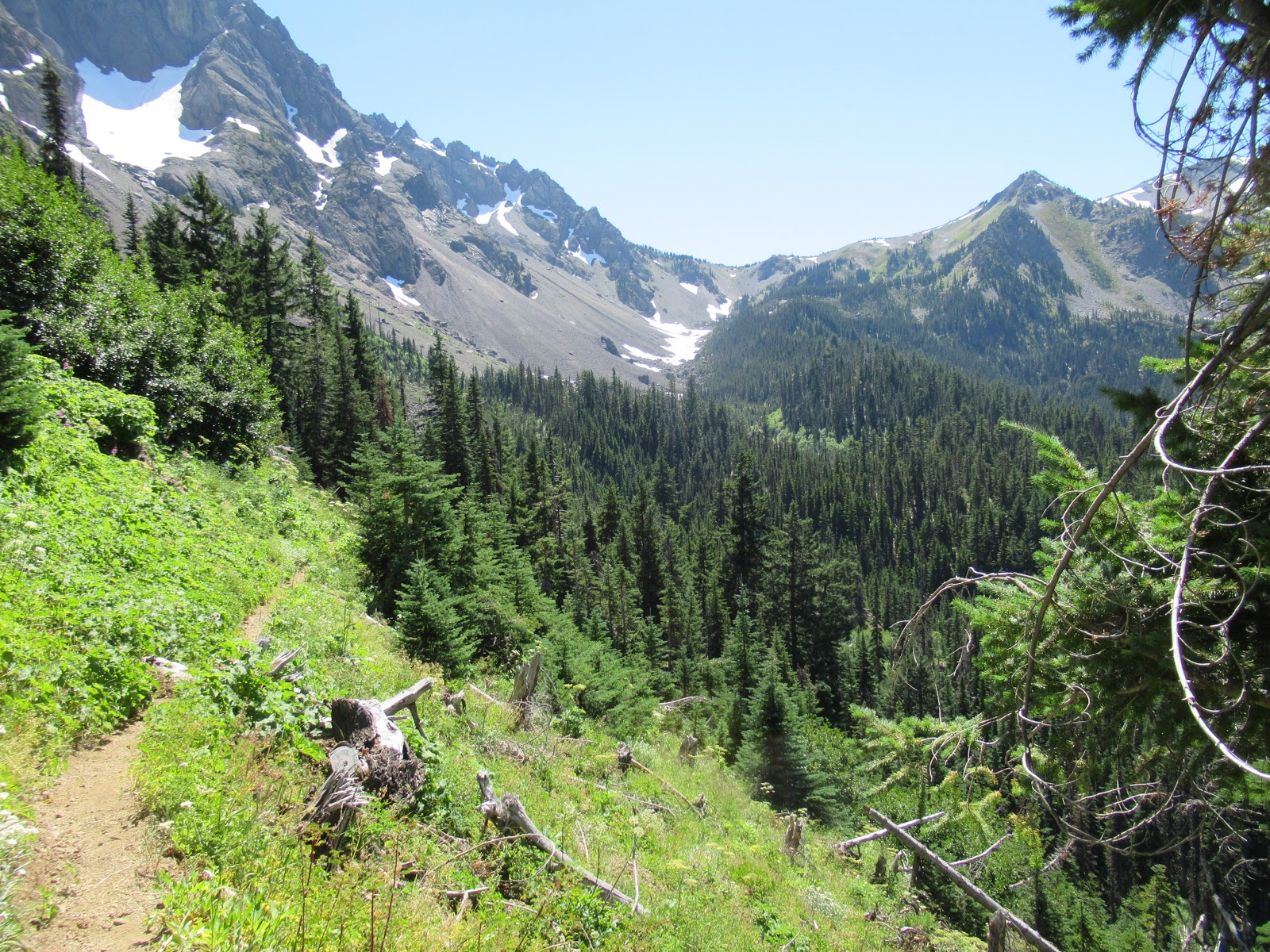
Looking out at the upper Dungeness River valley
 
I returned to Guy who was patiently waiting for me and we started back to the car. There was a nice breeze in our faces as we hiked down the valley. Go back about 4:00, home by dinner.

For this hike I bought new insoles for my boots to replace the worn Dr. Scholl’s insoles. The new ones seemed quite a bit better, with more padding under my feet. My feet were tired, but much better than last week’s hike up Mt. Townsend.

Friday, June 19, 2020

Mount Townsend, June 19, 2020

Mt. Townsend, June 19, 2020

Guy and I decided to try Mt. Townsend for our first hike of the year. Because of COVID-19, there’s not much to do around Silverdale, so it made sense to go hiking..

We left the house around 6:30 and got there about 8:00. There were quite a few other hikers on the trail. We started up the switchbacks in the cool morning. I felt kind of out of shape, and we took lots of short breaks. My boots didn’t seem to fit quite right, and I could feel a hot spot developing on my left heel. I adjusted my laces several times, but it still wasn’t really comfortable. 
 
The trail has a good surface and a wide tread.

I’ve been up this trail several times before, but I’d forgotten how the views start opening up about halfway up the trail. It was kind of hazy but we could see out across the sound. We were kind of slow, and lots of people passed us. Finally about 11:30 we arrived at the shoulder of the peak. Guy flopped down in the shade of a tree and rested. I decided to go the last little but to the top, and hustled up there. I could see the buildings in downtown Seattle.
 
On top of Mt Townsend.

Guy resting on the shoulder of the mountain.
 
I returned to Guy and we had lunch and took a good rest. I checked my feet and sure enough, I had a blister on my left foot. Put a blister bandaid on it for the hike down. Still had trouble because my toes were jammed up against the front of my boot and my toenails got pushed into my feet. By the time I got to the car, my feet were aching, my left knee hurt, and my back was cranky. I think I need to make some adjustments in my footwear.

Friday, August 30, 2019

Quinault to Duckabush Hike 2019

To get ready for my cross-Olympics hike, I packaged all my meals and double-checked my equipment list.


On Wednesday, August 21, I began my hike with a car drop-off. Guy and I drove our cars to the Duckabush River trailhead near Brinnon. I left my car there and Guy drove me around the Olympic peninsula to the Quinault Ranger Station. I got my permit ($38, ouch!), then Guy dropped me at the Graves Creek trailhead. It was raining while drove through Aberdeen, but it eased up when I started down the trail at 3:00 pm.
At the Graves Creek trailhead

My goal for this hike was to keep my average distance at an average of 6.5 miles per day. In past hikes, I’ve become completely exhausted because I overdid it. So my first day I intended to hike to O’Neill Camp, about 6 miles. But by 6:00, I was so tired that I grabbed a campsite at around 5 miles. I finished setting up camp just before the rain began, so I was able to keep dry under the tarp. It got dark a little after 8 pm, so I crawled into my sleeping bag and listened to a short story by D.H. Lawrence, “Shades of Spring.” Before I left, I loaded a number of audiobooks and music files on my phone.
My camp under the mossy maples on the Quinault River

The next morning I sat up in my sleeping bag, did Morning Prayer and made breakfast before packing up and starting on the trail a little before 9am. This is a lovely trail that goes through numerous open glades with bigleaf maple trees dotted here and there. I tried to take a rest break every thirty minutes so I kept up my energy, and this seemed to work pretty well.Had lunch in a sunny spot by their river and dozed in the sunshine.
Clouds hover on the cliffs above Enchanted Valley

I arrived at Enchanted Valley at 3 pm. I took a good long rest, then explored the meadow and found a campsite up under the big spruce trees. I made a watercolor along the River. There were a lot of people there, probably 6 or 7 campsites occupied. A woman horse packer brought a 6-horse pack train through with supplies for the trail crew working nearby.
My camp under the big spruce trees at Enchanted Valley

Made dinner, settled in for the night, solved a New York Times crossword puzzle and listened to “The Withered Arm,” by Thomas Hardy.

The third morning, I got on the trail by 8:05. I wanted to get an early start because I had a challenging day ahead of me: a climb of 2,400 feet up Anderson Pass. I labored up the trail and made pretty good progress. By noon I was nearly to the pass, so I stopped and had lunch at a switchback in the trail. Made it to the pass at 1:35 without too much sweat. There was a crowd of six backpackers talking with the ranger. I listened for a bit, then started downhill.
Looking back at the Quinault River from the Anderson Pass trail

Reached the turnoff to the LaCrosse trail at 3:15, found a place to camp and laid out my gear. It felt so good lying there in the shade with my legs glowing inside the sleeping bag as I rested with my back against a tree. Took a brief nap and felt quite rested. Stopping at 3 pm seems about right because it gives my body enough recovery for the next day’s hiking.

Made dinner and had dessert. It was apples slices with vanilla pudding and two shortbread cookies. The best part about my desserts this trip was the pudding and shortbread cookies. Did my usual crossword puzzle, listened to the first part of “Albert,” a short story by Leo Tolstoy. Drifted off to sleep.

On the fourth day, My plan was to hike over LaCrosse Pass, a climb of about 2,000 feet, a pretty good challenge. Started off with morning prayer and breakfast, as usual. On this trip I brought ¾ cup of oatmeal for every breakfast. Turns out that’s a little too much for me, but I usually managed to get it down. In addition to the oatmeal, I bring dried blueberries, a small baggies of brown sugar, and a couple tablespoons of whole dried milk. It makes a filling and tasty breakfast.

I started up the switchbacks to LaCrosse Pass at 8:25. It was cloudy and muggy as I made my way slowly up the trail. Lots of rest breaks. After a long time, the trail broke out into alpine meadows, with beautiful views of Mount LaCrosse to the west. The clouds were moving in, catching on the tops of the peaks and shrouding them.
Fog moving in near the top of LaCrosse Pass

Got to the pass at 11:45, just before it started to rain. Put on my rain gear and the pack’s rain cover and started downhill. Found a dry place to eat lunch under some thick trees, but it was too wet and cold to rest very long. Kept going down the switchbacks, and after a half hour it quit raining so I stripped off the clammy rain gear.

There were about 30 switchbacks going down 3,000 feet. The bottoms of my feet burned and my thighs ached, even though I took many small breaks. Finally I made it to the Duckabush trail at 2:35. Took a good long break and started down the Duckabush trail. I met six teenage girls probably 14-16 years old followed by their three adult sponsors, on their way to Upper Duckabush Camp.
At the junction of the LaCrosse Pass trail

As I continued down the trail, the sun came out and made it a pleasure to walk through the dappled old-growth forest on a gentle downhill tread. After what seemed like a long time, I reached Crazy Creek Camp at 4:30, quite tired out. I’ve camped here twice before, so it felt like home. Took a rest, explored a bit, took some photos of the Crazy Creek Falls.
Crazy Creek Falls

Made Zatarain’s red beans and rice for dinner. It was pretty good but I didn’t make all I had because I wasn’t that hungry. Again did the crossword puzzle, listened to the second half of “Albert.”

The fifth morning was Sunday, so I did morning prayer using the Sunday lessons and thought about what I would preach about if I were in church. The OT lesson was Jeremiah’s call to preach. “The Lord put his word in my mouth,” he said.

Hit the trail about 8:30 because I wanted to reach Five Mile Camp, about 8 miles. After five days, I’m getting tired, and the miles seem to drag. I stopped at Ten Mile Camp at 11:10, kept going, had lunch and a short nap in a burned area down the trail.

The afternoon was a slog, but I arrived at Five Mile Camp at 3:15 and was able to take a good rest. I met a park ranger who was studying spotted owls. He had just returned from setting voice recorders in the woods. He said the barred owls re driving the spotted owls out of this valley. He had a rangy young dog on a leash and a big stash of food he’d left near the river. Made dinner, did the crossword, listened to Act One of Macbeth. There was really good voice acting in this production, and I had to listen to some Beethoven piano sonatas to get my mind off the murders in the play before slipping off to sleep.
My camp under the shelter of a huge boulder at Five Mile Camp.

I awoke feeling kind of creaky on the sixth morning. Did morning prayer, had breakfast and hit the trail by 8:15 or so. Started up the switchbacks to Big Hump. Made pretty good progress, but felt really tired. Took a break on the big rock outcropping and texted Katy. Continued on down the switchbacks t the river, then rested at the campsite by the river where I’ve camped before.

Kept slogging along and got to Little Hump by noon, when’s I stopped for lunch. My lunches consisted of wheat crackers, peanut butter in a tube, cheese, raisins, and a piece of chocolate. The wheat crackers were excellent when I began, but by the last day they were soggy. The cheese and raisins were my favorite part of lunch.
Looking out at the lower Duckabush Valley.

I came out into the trailhead parking lot at 1:15. When I dropped the car off, I forgot about the Forest Service fee for parking, so when I got back, it had two yellow tickets on the windshield. I groaned, thinking of enormous fines, but it turned out to be only two tickets for $5 each. I can handle that.

Drove to Highway 101, texted Katy that I was on my way, and drove home. Stopped at Quilcene for an ice cream cone and an Americano from the coffee hut. It felt strange driving along and listening to the same old news on the radio. Got home at 2:30, kisses Katy and took a shower. Ahhhh.

Monday, August 28, 2017

Skyline Trail, August 21-26, 2017

Hiked the Skyline Trail in ONP. It climbs up the ridge between the Quinault River and the Queets River, traversing some spectacular alpine scenery. A primitive trail in rugged terrain, it doesn't get much use and is no longer maintained. Wore me out completely. 51.4 miles, 10,000 feet (!) elevation gain.

I left Silverdale right after church, had lunch in Aberdeen and arrived at the Quinault Ranger Station about 3 pm and got my permit. Drove to the trailhead and started hiking at 4. I looked pretty chipper when I started at the trailhead on the North Fork of the Quinault River.

Arrived at Big Creek about 7 pm. It was cool and shady down in the bottom of the canyon. Found a nice spot on a gravel bar for my camp.

 
On Monday morning, I started up the trail during the eclipse. Not too noticeable, but there was an eerie shadow for a while.  Pleasant hiking past Three Lakes Camp.

Monday night I camped at Three Prune Camp where I was joined by five hikers about my age. A fascinating tribe of kindred souls. They invited me for a drink and we had a gabfest. 

Tuesday morning. The trail goes higher and higher up the ridge through alpine meadows.
 
 I stopped for lunch at the divide between the Quinault River and the Queets River. Looking down into the Queets
, you can see the dead trees from the 2015 Paradise fire.


Traversing below Kimta peak. The trail in this section is rocky, steep and crumbling. 

 More traversing below Kimta Peak.

 Can you see the elk bedded down in the meadow? 

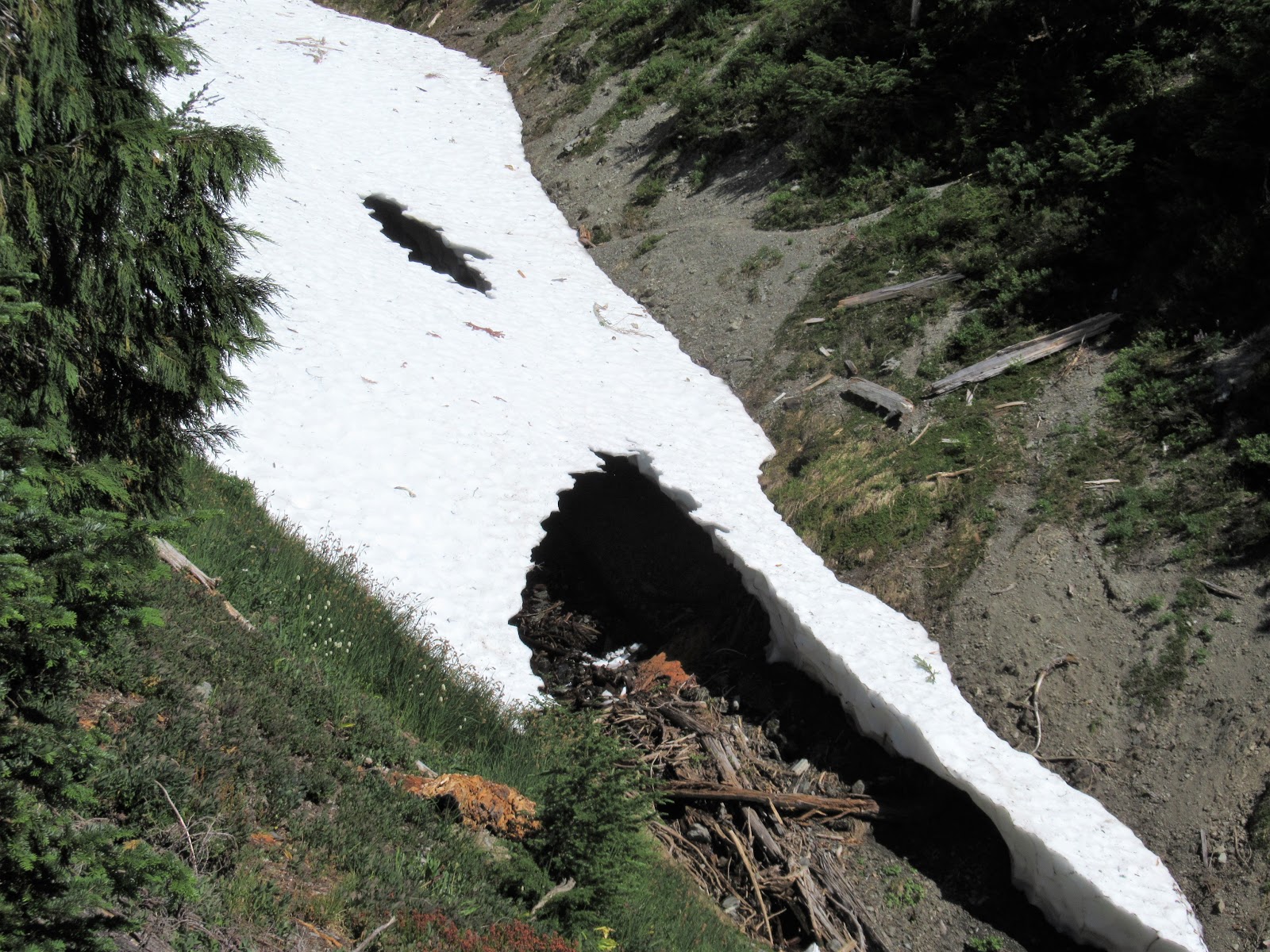
Where should I cross this snowbridge? I skittered across far above the scary black hole.


An old burn near Promise Creek Pass. 


I arrived at Promise Creek Pass at 5 pm, totally worn out. I abandoned my plan to continue to Lake Beauty and found this pretty spot below the trail. Unfortunately, the mosquitoes were the worst I've ever experienced. Torture. 
On Wednesday morning, the mosquitoes were already divebombing at 6 am, so I got up and hiked to the top of the ridge where the breeze kept them off. Ate my muesli while I looked across at Mount Olympus.

Passed a pretty tarn in a section called the Moonscape. 

The Moonscape is barren rock and scree, and the only way to find the route is to follow rock cairns that show the way. Eerie and beautiful. 

After several hours of traversing a series of v-notch canyons that required going down very steeply, then up very steeply, I arrived at Lake Beauty. Mount Olympus is beyond. 

The trail goes down to Seattle Creek, then up to the rolling meadows on the shoulder of Mt. Seattle. I was exhausted at the end of this 13 hour day. 

The campsite at Low Divide was blessedly welcoming. Three guys nearby provided good company. 

On Thursday, I took a day hike to Martins Lakes so I could say I did. Another thousand feet of elevation gain to get to a very pretty setting. Four Boy Scouts joined me at this lake, providing entertainment for me. One of them went swimming in the lake. 

On Friday it was just a matter of hiking 15. 7 miles out the Quinault River. This is the ford at 16-mile Camp. It was about knee-deep at 10 in the morning and I crossed easily. 

One weary traveler back at the trailhead on Saturday morning. This hike was way tougher than I anticipated. It kicked my butt. I'm glad I did it, but I'm not doing it again! 


Tuesday, August 1, 2017

Home Lake and Del Monte Ridge, July 31 - August 1, 2017

A lovely two-day hike up the Dungeness River to Constance Pass and Del Monte Ridge. Great weather, abundant flowers, and terrific views.

I had hoped to leave home Sunday afternoon and hike to Camp Handy Sunday night, but I was reluctant to leave because my parishioner John Steller was near death. I had visited several times and anointed him with oil the day before, but I didn't want it to look like I was abandoning him and his family. I talked with his wife, Janet, and she assured me I should go. I contacted Dick Scott, a retired priest, and he said he'd be glad to visit at the time of death. So I felt free to go on Monday morning.

I left home at 7:15 am and started hiking at the Dungeness River trailhead at 9:00. The morning was cool and pleasant and the first few miles reeled off easily.


I love the grove of huge firs on the lower part of the trail.


A photo taken with the camera timer.

By mid-morning I was sweating up the inclined trail to Boulder Shelter. Three vigorous and fit women in their fifties passed me at the river crossing. Two women in their seventies passed me, then I passed them. Then a group of five hikers passed me while I was resting. When they stopped for lunch I pulled ahead of them and kept going. Quite crowded on the trail.

\As I approached Boulder Shelter, I started seeing wildflowers. They were out in full force this time of year. These are harebells.

A field of flowers near Boulder Shelter.


As I progressed up the valley, the trail eased up and I began to see ahead to the skyline and the pass. I was quite tired by mid-afternoon and went slowly. I crossed a rocky-strewn slope and entered the last incline to Home Lake. I arrived about 4:00. I met a man in his fifties and his teenage daughter who were camping at the lake and had a pleasant conversation.


As the sun was setting, the side of Mount Constance began to glow with sunlight. I grabbed my watercolors and made this painting, swatting away mosquitoes as I painted:


My camp overlooking Home Lake.

As the sun began to set, the alpenglow on the ridge to the East was lovely.

The next morning I awoke by 6:00, had breakfast, and started up to the pass by 7:00. There were flowers everywhere.

Switchbacks on the way up to the pass.

 At Constance Pass.

Looking off to the South, I could see the back side of The Brothers.

From the pass, I continued up the ridge, with the views increasing at every step. It's wide open tundra, easy going.

From the ridge, I could see the entire Dosewallips drainage including Anderson Pass, Lost Pass, and Hayden Pass. Grey Wolf Pass was hidden behind the ridge, but I could look down on all the trails I have hiked.


Wandering in the alpine. I felt free and elated to be in the high country.

Fields of flowers.

"The joy of the universe came rushing to meet me and I embraced here. Yes, yes O yes!

I started down the moutain and arrived at my camp at 9:20. I took a half hour break and started out at 9:50.

Home Lake see from above. You can just see the first wisps of smoke coming into our area from the fires in Canada. The smoke would last for a week before it cleared away.

There were fields of flowers on the way out.

Big flowers against a dark background.

Had lunch at Boulder Shelter and continued down the trail This is just below Boulder Shelter. Returned to the car at 4:10 and drove home, stopping for ice cream and coffee.