August 16-22, 2020
 |
Starting out from the trailhead at Sol Duc River
|
I've been planning this hike all summer. I spent the week before the hike getting my gear together and dehydrating food for my meals. I made lists and checked everything off so I knew I was ready. On Sunday after church I came home, took a brief rest, and loaded up my gear in the car. I'd hope to get away by 3:00, but there are always last minute things to do, and I didn’t get away until 4:00. I arrived at the Sol Duc trailhead at 6:30, sat down at one of the picnic tales and had a cold dinner of crackers, summer sausage, cheese, raisins, and cookies.
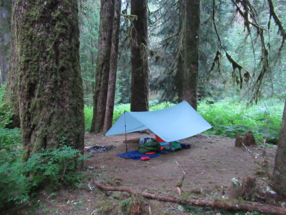
At 7:00 I shouldered my pack and started up the Sol Duc trail. There were still quite a few people coming down the trail, although it was getting near dusk. I hustled along because I wanted to get to my campsite before dark. Made it to the Sol Duc Falls junction in 20 minutes and kept going. Finally at 7:55 I arrived at Sol Duc Campsite #1. I quickly found a tree to hang my food in, slung a rope over a branch, and hauled it up. This campsite is just a wide spot in the trail, but it’s under huge Douglas Fir trees and quite nice. Settled into my sleeping bag and listened to my MP3 player.
 |
Sol Duc Campsite #1
|
On this trip I listened to The Greatest Thirty Orchestral Works with Professor Robert Greenberg.. He’s a very articulate, enthusiastic speaker. He explains The structure of the music and offers a biography of the composer. This trip I listened to him discourse on Mozart and Hayden. After a few nights I started listening to Cannery Row by John Steinbeck. Last year I listened to Tortilla Flats by Steinbeck. The books are quite similar, each one about a group of ne’er-do-well bums and scalawags who experience a series of delightful misadventures.
I fell asleep but later I woke up to lightning and thunder off to the west. The forecast had no rain in it, but I got up and set up my tarp, just to be sure. It never did rain.
Woke up under the big firs feeling fresh. Had breakfast and started up the trail by 7:30. It was a lovely summer day, with deep blue skies and temps in the 70s. I got to the trail junction and started up the switchbacks to Appleton Pass. It was a good trail and I took my time going up. I’m in pretty god shape because I had Seven day hikes this summer to prepare for this trip. I made it to the top of the Pass about noon and settled down to eat lunch.
 |
The trail up to Appleton Pass
|
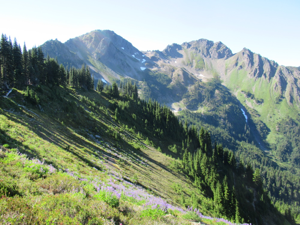
The pass crosses an open ridge with great views to the north. I looked down on the Boulder Creek drainage and I could see across to Happy Lake Ridge as well. Lots of great campsites along Appleton Pass, and I chose one just above Oyster Lake. Had lunch, rested and took a nap. In the afternoon I wandered up the ridge to a small peak that overlooked the valley From there I could see off to the south, including Mount Olympus, with its massive shoulders of glaciers and peaks, as well as Seven Lakes Basin and Deer Lake.
 |
Mt. Appleton. My camp was to the left of the photo.
|
 |
Looking down on Oyster Lake
|
 |
| Mt. Olympus |
I met a young guy camped on top of the ridge in a meadow and two Park Service scientists who were taking water samples from Oyster Lake.
Came back to my campsite and made dinner but the mosquitoes were fierce. Ended up wearing my headnet while I cooked, but the skeeters swarmed all around my head. Any exposed flesh was immediately attacked. Had to eat lifting my headset one spoonful at a time. Laid down in my bag to go to sleep but they still swarmed me, and it was too warm to really close off the sleeping bag. It was long after dark when it got cool enough for the mosquitoes to subside. Then during the night a cold breeze came up across the ridge and made me uncomfortable. Didn’t sleep very well.
In the morning the mosquitoes were out in force. I made breakfast and ate it walking in the meadow trying to keep the mosquitoes off. It was a relief to start hiking. The trail down the north side of the Pass plunges down a series of steep switchbacks, then travels through a jumbled canyon where the trail is rocky and brushy. In places the brush was well over my head and so thick it obscured the trail beneath my feet. Awkward going.
 |
| Bridge across Boulder Creek |
Kept on going through a series of switchbacks down to the lower part of the trail. Stopped to take a look at Upper Boulder Creek Falls. Very steep canyon that makes it difficult to get a good view of the falls. Went a little further and stopped off at Lower Boulder Creek Falls. Although not as tall as the upper falls, they’re quite impressive. Took a video of the water roaring over the falls.
 |
Lower Boulder Creek Falls
|
Continued down the trail, rather tired, and got to Boulder Creek Campground about noon. Asked directions from a couple in their thirties who said showed me where the campsites were. The campground used to be a car campground until the road washed out, so there are nice big camping sites under big fir trees. Quite a lovely place. I took ownership of a nice open site with a big log to lean up against. Had lunch, took a nap and relaxed. Put my food up on the bear wire and looked around a bit. The nearest water is all the way down at the creek, which was a five minute walk down the switchbacks. Got water, returned to my campsite to rest up.
 |
| Relaxing at Boulder Creek Campground |
|
Later I went down to the creek, crossed to nice big footbridge and looked for the hot springs. The first looked like a big mud puddle with rocks around it, and the second was about the same but larger. Not very inviting. I wandered further until I saw a trail going straight up the hillside. I followed it and found a nice little hot spring pool. The water was clear so I took off my clothes and eased myself in. It was just the right temperature, like a hot bath. There was a stone to sit on so I didn’t have to sit on the mud bottom. It was pretty relaxing. Returned to camp, made dinner, listened to The Thirty Greatest Orchestral Works.
 |
Hot springs pool
|
In the morning I woke up early, had granola for breakfast and started hiking by 7:00. I knew I had a long day ahead and wanted to get an early start. I hiked down the old road which has been abandoned by the Park Service and turned into a trail. Nice easy hiking. Got to the Happy Lake Ridge trailhead by 8:45, took a break and started up the switchbacks at 9:00. It was a lovely clear morning with blue skies and cool temperatures.
 |
The trail up to Happy Lake Ridge
|
The trail is steep but the ascent is steady and the tread is very good, mostly pine needles. I took it slow, stopping whenever I was out of breath and resting fifteen minutes after every thirty minutes of hiking. By noon I had made it to 4,000 feet and took a 45 minute lunch break. Continued on and had some nice views of Mt. Olympus and Mt. Carrie to the south. When the trail reached the top of the ridge, it leveled out a bit and I made it to the junction t9 Happy Lake by 3:00. Sat down, pulled out my phone and called Katy. I was shocked when she answered and sounded like she was right next to me. I asked if she could pick me up at the Elwha River and take me back to my car. That way I wouldn’t have to go back over Appleton Pass on Friday when it was likely to be raining. It was great to hear her voice.
Started down to the trail to Happy Lake. By this time it had clouded over and it felt like a front was moving in. The trail to the lake is kind of rough and steep, but I got there by 3:30. Looked around a bit and found a campsite under a tree that provided some protection from the wind. While I was resting, the guy I met at Appleton Pass showed up. We had a short chat and I left to set up my camp. I was pretty tired after climbing 3,700 feet in elevation.
 |
Happy Lake on a cloudy afternoon
|
 |
My campsite at Happy Lake
|
Happy Lake was dark green, hemmed in by trees with a couple of grassy areas near the upper end. With the clouds moving in, it seemed like kind of a gloomy place. Maybe in the sunshine it looks like a happy lake. Set up camp, made dinner with m6 headset on to ward of the mosquitoes. At least they weren’t as bad as the previous night.
It rained during the night, but I was dry and warm under my tarp. Woke up, had breakfast and started by 8:30. I was still tired after yesterday’s ascent so I struggled to make the miles on this day. The brush was wet from the rain so I put on my rain pants which made it which more comfortable. The hiking was fairly easy along the ridge, with the trail dipping and rising every so often. I had a few good views of Aurora Ridge, but the clouds prevented me from seeing Crescent Lake or any other view. I had intended to hike the 1.8 miles out the Aurora Ridge trail to pick up that section, but I was too tired and it was too wet.
 |
The trail along Happy Lake Ridge
|
 |
Looking off toward Aurora Ridge
|
Took a break when I reached the junction, then started down to Boulder Lake, shrouded in clouds. The trail goes steeply down and has a series of switchbacks before it gets to the lake. Arrived about noon and took a good break in the nice campsite in a cluster of trees.
 |
Lunch at Boulder Lake campsite
|
 |
Boulder Lake
|
After lunch I took a walk through the meadows near the lake and enjoyed lots of wildflowers. It began to rain lightly as I left the lake and started downhill to Boulder Creek Campground. I met a couple of women coming up for a day hike. I was tired but I wanted to get to camp before it rained so I kept going.
Got to camp about 3 pm and settled my bones under a cedar tree that kept the rain from falling on me. After a while I got up and set up my tarp between two big trees. Pretty nice campsite with lots of flat area. The rain began to fall steadily but I just curled up with a crossword puzzle. Made dinner and lowered the tarp so no rain could get under the edges. Slept warm and dry.
 |
My camp at Boulder Creek Campground
|
Woke up to light rain, had breakfast, started down the same trail I hiked on two days before. The rain increased, and by the time I passed the Happy Lake trailhead it was really raining. I had my rain jacket and rain pants on, and I put the rain cover over my pack. It was pouring for a good part of the way. Passed a number of young people going up the road, about half of them on bikes. One young women on a bike was soaked but she seemed quite cheerful as she pedaled up the road. I could feel the rain starting to penetrate my rain gear.
 |
Rain in the trees on the way down the road
|
 |
Rainy hiking
|
Finally at noon I stopped at the site of the old dam. There was an outhouse there with a small porch, so I curled up out of the rain and had some trail mix. It felt good to rest up out of the rain. Continued down the road. More people came by, including young families. Crossed the bridge and came to the ranger station and warehouse compound. I sat under the porch of one of the buildings and had lunch. Took a good long break because I was tired. It stopped raining and began to show some small patches of blue sky.
As I sat there, I imagined what it must have been like in that compound in the fifties and sixties. Crews getting ready to go out on the trail or returning, supplies being loaded and unloaded, trucks, horses, men milling around. It must have been an exciting place to be. I’m glad that they’ve reroofed the building with cedar shakes and seem to want to preserve the buildings.
Walked on down the road expecting to camp at Elwha Campground. Unfortunately it was washed out when the road was washed out by the river. I had to take the bypass trail to get around the washout and it was more difficult than I expected. I was fatigued, so climbing up a couple hundred feet seemed like a long ways. Finally got around it and I could see the Madison Falls parking lot, so I started looking for a place to camp. Took a fisherman’s trail along the river but it was overgrown with trees and brush. Finally found a tree to sit under and take a break. After a while I found a place near the river, but I waited to set up there because so many people were passing by. The trailhead at Madison Falls parking lot was jammed with vehicles and there was a steady stream of hikers up the road. The sun came out for a while and made the river sparkle, and I soaked up the warm sun. Finally made camp, had supper, and put up the tarp.
 |
The sun breaks through on the Elwha River near my campsite
|
 |
My campsite near the Elwha River
|
I slept well. In the morning I had breakfast and started down the road. Strange to walk on a road with regular houses on it. By 9:30 I came out on Highway 101 and waited for Katy to pick me up. She arrived precisely at ten. It was good to see her and know I had reached the end of my journey. We drove to Sol Duc trailhead, picked up my car and started back home. We stopped at Crescent Lake Lodge and had a picnic next to the lake. I was hungry and the food tasted great. We got home by about 3:00.