I love to go a-wandering off the beaten track,
and as I go, I love to sing, my knapsack on my back.
Val-di-ree, Val-di-rah,
Val-di-ree, Val-di-rah-ha-ha-ha-ha-ha-ha
Val-di-ree, Val-di-rah,
My knapsack on my back.
Showing posts with label Quinault River. Show all posts

Tuesday, August 18, 2015

High Olympics Hike August 14-18, 2015

Katy drove ten hours on Friday to drop my car at Duckabush River and drive me around the Olympic Peninsula to Graves Creek Trailhead on the Quinault River. I hiked about 49 miles in five days with 4,300 feet elevation gain, right over the top of the Olympic Mountains.

Linsley Glacier from O'Neill Pass Trail

When Katy took this photo at the trailhead the first time, my camera said, "Battery Exhausted." Thinking quickly, Katy said, "I'll charge it up with my laptop." She plugged it in and half an hour later I was ready to go. She saved the day.

It was cloudy and misty as I hiked up the Quinault River. My shirt was soaked by the time I got to O'Neill Creek Camp at 6 pm.

On Saturday morning I joined the parade of hikers going to Enchanted Valley. I met three chattering young women who asked if I wanted them to take my photo at this enormous cedar rootwad. Of course!

The upper crossing of the Quinault River is this skinny footbridge high over the river. When I got to the middle, I went hand over hand, trying not to look down. The guidebook doesn't mention this!

I can see how Enchanted Valley got its name. This old chalet was built in 1930 and served as a resort lodge before WWII. It's located in a large meadow with cliffs looming above. Other hikers told me that in a normal year there are dozens of waterfalls cascading down the cliffs. It's enchanting.

I continued on and hiked up to O'Neill Pass Trail. It was a good amount of elevation gain but my legs and lungs stood up pretty well. I met several members of a trail crew who told me about torrential thundershowers the day before.  I arrived at White Creek meadow about 4 pm. This is a long meadow formed by avalanches that thunder down from the cliffs above.

Sunrise Sunday morning on West Peak above my camp in White Creek meadow.

Looking down at White Creek meadow and across to West Peak and Mt. Anderson.

Linsley Glacier is a beautiful blue-white hammock nestled under Mt. Anderson. It's visible all along the O'Neill Pass Trail that traverses for miles along the mountainside.

As the trail turns eastward, the entire Quinault Valley unfolds below. You can just barely see Lake Quinault near the horizon.

On Sunday afternoon I left the trail to hike cross-country to Lake Ben. I had to cross Upper O'Neill Basin and climb over the ridge in the center of the photo. There were some elk trails but they weren't much help. After much sweat, I made it to the ridgetop about 3 pm.

Looking down into Lake Ben Basin. This is one of the most breathtaking places I've been in the Olympics. It's a pristine glacial cirque with no evidence if humans. No boot path around the lake, no tent circles, no campfire rings, just elk tracks and a bear feeding on huckleberries high above the lake.

My camp at Lake Ben at sunrise Monday morning. I woke up in the night shivering, and got up to see a miraculous spread of stars across the sky, the Big Dipper on the northern  horizon. I could almost hear my dad pointing it out to me fifty years ago. I added my fleece sweater and spread my gore-tex parka over my legs and went back to sleep. The morning air was pure, fresh and bracing. I felt fully alive.

I sweated my way back over the ridge and re-joined the trail and soon I was at O'Neill Pass. Linsley Glacier appeared again like a recurring dream.

Looking to the South I could see the hanging glaciers on Mt. Duckabush. O'Neill Pass is the low place on the horizon.

From there it was all downhill. I hiked until late in the afternoon, down through the stands of timber as the shadows lengthened. I was so tired I stumbled and rolled my right ankle, causing some pain for the rest of the afternoon.

At five pm I arrived exhausted at Ten Mile Camp and quickly made camp.  Nearly fourteen miles that day.

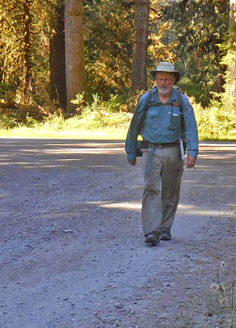
The next morning I packed up and walked out the last, very long, ten miles. When I got home, Guy made a big juicy hamburger for me on the grill and Katy had fresh tomato pie with tomatoes from her garden.

I brought an audiobook on this trip; Eventide by Kent Haruf. It's about a set of characters in a small town in eastern Colorado, revolving around two bachelor brothers in their sixties who have operated a ranch together all their lives. The dialogue is lean, pitch-perfect for the dry midwestern mileu. I enjoyed it immensely, finishing on my last night.

Wednesday, August 13, 2014

Elwha to Quinault hike August 3-8, 2014

I took five days off work to make a hike I've been thinking about for a long time, an across-the-Olympics hike from Whiskey Bend on the north side of the park, up the Elwha River to its headwaters, over Low Divide, and down the Quinault River on the south side of the Park, about 44 miles. Click here for a Google Map of my trip.


I planned this trip carefully, especially the menus for my meals. I used Katy's food evaporator to dry ham, chicken, hamburger, and chili for dinners, and bananas, strawberries, apples and peaches for desserts. It worked out very well -- I had delicious meals and the cost was way lower than buying freeze-dried meals.

On Sunday after church, Katy drove me to Port Angeles where I got my permit at the Park Wilderness Information Center. We picked up a sandwich to eat and the trailhead and Katy got this photo of me before I headed up the trail at about 6:30 pm.

I hiked to Hume's Ranch as the sun was going down and got there in time to see the sun illuminating a  meadow of golden grass.

I camped below the cabin in a meadow under two big grandfather trees. After dusk I heard some snorting and looked up to see the shapes of two deer feeding in the meadow below me.

In the morning I hiked up to the Elwha bridge that leads to the Dodger Point trail. There's a suspension bridge over the Elwha River that's a nice piece of engineering. Then I hiked back to the Elwha trail and started upriver.

The trail has a surprisingly large amount of elevation gain to get above the Grand Canyon of the Elwha. After Lillian Camp it comes back to the river level.

The beautiful clear waters of the Elwha flowing past the trail near Mary's Falls.

Found this delicate blue eggshell on the trail. 

One of my favorite places in the Elwha is Elkhorn Camp, a beautiful meadow in the middle of the wilderness.

About 3 pm I reached Riemann's Cabin. A plague on the cabin said iot was built in 1926 by Grant Hume (of Hume's Ranch) for  Mr. Riemann, an attorney and judge from Tacoma who used to come every year for a big fishing expedition. The cabin has exquisite workmanship.

The Elwha River and the sun going down on the ridge above Riemann's Cabin.

Near my camp at Riemann's Cabin.

Preparing for dinner at my campsite. Three young guys came in near dark and camped nearby.

On the second day of my hike, I traveled through endless tall forests alongside the Elwha River. I got an early start and hiked for hours in the cool morning air with shafts of sunlight streaming through the trees.

It's impossible to show the height of the trees along the Elwha River. They soar high into the air, probably 200 feet tall or more. Awe-inspiring.

A nice piece of trail work.

The tree behind me is at least five feet in diameter.

About 3 pm I arrived at Chicago Camp. I was pretty well worn out, so I took a nap and read from my book, Gilead by Marilynne Robinson. It's the fictional journal of John Ames, a congregational minister, writing in 1956 at the age of 76, to his son who is 7 years old. The book is very Old Testament-ish. Ames is an Abraham-type figure, writing about his family history (his father and grandfather were also Congregational ministers). At the same same time a drama unfolds involving his godson, and secrets are revealed. I really enjoyed the book, especially considering my great-grandfather and great-great-grandfather were Congregational ministers. I rationed the number of pages I could read each night so I didn't finish too quickly, and as a result re-read some passages.

Elwha Basin
On day three I got up early and made a side hike to Elwha Basin, about three miles. When I got to the Basin, I could see up to the alpine ridges of Mt. Queets and Mt. Noyes. Returned to my pack at Chicago Camp and started up to Low Divide.

I thought that I would have to ford the river at this point, but this tangle of blowdown trees provided a way to cross without getting my feet wet.

After I crossed the river, I was walking across the river stones when I felt a sharp pain in my right calf. I had torn this muscle two weeks earlier, and now I re-injured it. I stopped and massaged my calf, but eventually I had to start up the trail, trying to baby my right lower leg. The trail up Low Divide is steep, and I went slowly, taking lots of short breaks to catch my breath and give my leg some rest. I had lunch about halfway up. By 2:10 I was at the top and got to look back at the Elwha River watershed.

Looking back at the Elwha River watershed.

The huckleberry bushes were loaded with berries. Luckily I didn't run into any bears.

Lake Margaret at the top of Low Divide. I met elevn Boy Scouts and their leaders on their way to go swimming in the lake. I also passed eight young hikers crossing the divide, as well as a few more hikers. A crowded place.

Proof that I made it!

I made my camp at the edge of a meadow, right next to the Boy Scouts' camp, and read my book while my muscles recovered. After dinner I chatted with the scout group for a little bit. They were a Mormon troop from Auburn. 

Sunrise from my sleeping bag.

By 7 am on Day four I was hiking down from Low Divide to the Quinault River. By 9:30 I arrived at Sixteen-Mile camp where I had to ford the river. I took off my boots and put them back on without socks to cross the river. It came about halfway to my knees. I was glad it wasn't any deeper. After crossing, I put my dry socks back on with my wet boots. It wasn't too uncomfortable. Having a pair of good wool socks helped a lot.

Lunchtime found me at Elip Creek, where I ate my lunch and took a nap on my foam pad. So tired at this point.

I kept walking down the Quinault River. This side of the mountains is a lot different from the Elwha valley. The Elwha is long and gradual, but the Quinault is a catacysm of erosion, blowdown and crashing streams. The trail is good, though, and I made good time, arriving at Wolf Bar by late afternoon.

The Quinault River near my campsite at Wolf Bar, with the sun going down. A couple of young guys camped near me.

On Day five, I got started by 7 am and made it to the trailhead just after 8 am. 

This quaint old ranger station is near the trailhead.

 I hiked down the road in the cool early morning air.

Wearily making miles on the road.

I finally hitched a ride with a lovely young family in a tiny Volkswagen station wagon. They stopped when they saw me and apologized, "We're full," but a moment later they stopped again and said, "We think we can squeeze you in." the wife got in the back seat with their two young children, maybe six and four, and I held my pack on my lap. They were from California, traveling up the West Coast, stopping at all the National parks. The kids were so much fun, chiming in with their little voices. What a treat.

They dropped me off at Amanda Park, where I caught the bus to Aberdeen. I caught a quick eye-full of rural poverty while waiting for the bus and riding to Aberdeen. Greasy-haired bikers, haggard old ladies with Appalachian faces, Native American kids with big sneakers, overweight moms with kids in tow. Aberdeen is a post-apocalyptic town with decaying industrial buildings, empty storefronts, and the scary-looking homeless people in the downtown area. I walked to Safeway, got a Starbucks coffee and a copy iof the New York Times, and waited at the transit center for the bus to Olympia.

At the transit shelter in Aberdeen.

In Olympia, I had time to kill while waiting for Katy who was caught up in nasty Friday-afternoon traffic. I walked around downtown Olympia and hung out with the homeless people in the city park.

Olympia City Park

When Katy picked me up, we went to Darby's Cafe and celebrated the end of great hike with a sandwich and beer.