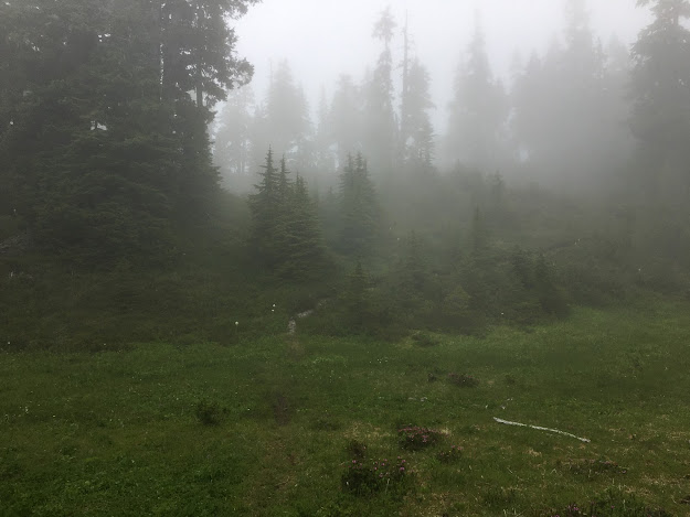
I love to go a-wandering off the beaten track,
and as I go, I love to sing, my knapsack on my back.
Val-di-ree, Val-di-rah,
Val-di-ree, Val-di-rah-ha-ha-ha-ha-ha-ha
Val-di-ree, Val-di-rah,
My knapsack on my back.
Showing posts with label "Olympic National Park". Show all posts

Wednesday, July 29, 2020

Little Divide Hike July 28, 2020

From the Sol Duc Hot Springs trailhead to Mink Lake, up to Little Divide, along the divide to Deer Lake, down to Sol Duc Falls, the along Lovers Lane trail to the car at the trailhead. 14.0 miles, 2,400 feet elevation gain.

I left work about 4:00 on Monday afternoon and drove to Sol Duc. After stopping at Fairholme campground and seeing it was full, I drove to Sol Duc Hot Springs and looked for a place to sleep that would be out of the way of the park rangers. I walked down Lovers Lane trail about five minutes and found a perfect place near the river, just off the trail. Returned to the car, drove to the Sol Duc Falls trailhead where I sat at a picnic table and had dinner. Lots of people come out from the trail. About 8:30 I drove back to the Hot Springs, parked, and took my sleeping bag and big foam mattress to my camping spot. Slept well. Woke up in the night to see the stars peeking through the vine maple leaves just above me.

Got up, walked back to the car and set up the Coleman stove behind the car and made breakfast. Coffee and granola. Started up the trail at 7:15 am. It felt pretty good to go up the switchbacks in the cool air. Made it to Mink Lake at 9:00. Stopped at the shelter, met to talkative young women who were planning to hike up to Little Divide, down to Deer Lake, and up to Lunch Lake. Hope they got started soon after I left. That's a stiff hike.

Mink Lake
Mink Lake

Kept on going up to the divide. The trail goes up but not too steeply and I still felt fairly fresh. Made it to the junction at 10:25. Started in an easterly direction along the divide between the Sol Doc valley and the Bogachiel watershed. Really a lovely trail along the ridgetop or traversing slightly below the ridge. There was a cool breeze blowing from the Bogachiel valley that kept the mosquitoes off. The tread of the trail was soft and easy. Not many people hike this trail.

Little Divide trail

At 12:00 I arrived at the place where the trail drops over the ridge and starts down. Stopped for a leisurely 30-minute lunch with the breeze coming through the gap. Took my boots off, laid down in the sun, and rested.

At lunch

Started off again, down to Deer Lake. Arrived at 1:15. Lots of people, including families. I could hear their voices across the lake.

Deer Lake

Started down the trail below the lake. It's a terrible trail, quite eroded and full of rocks and boulders.


By this time my feet were starting to hurt. My boots are wonderfully supportive but after eight miles my feet hurt anyway. Passed lots of people coming up to Deer Lake, including a group of eight young women. I had my mask around my ears and tucked under my chin. When I saw anyone approaching, I pulled it up until they passed. A lot of people would guiltily raise their mask when they saw me or turn away from me and cover their mouth and nose.

Mask at the ready


Sol Duc Falls

Got to the Lovers Lane trail junction at 3:15, took a break to rest my feet. Made a quick detour to photograph the Sol Duc falls, then started on the Lovers Lane trail back to the car. It was pretty flat, easy going, but I was tired and my feet were in pain. Slogged along trying to appreciate the towering douglas fir trees and tall ferns. Made it back to the car at 4:15, took off my boots and rubbed my poor feet before putting on softer shoes.

Drove home, stopping at the Starbucks drive-through in Sequim for coffee and a cheese danish. Boy, was it good.


Friday, July 17, 2020

Sundown Lake, July 17, 2020

Hiked up over Wynoochee Pass, down to Graves Creek, then up to Sundown Lake. Returned the same way.

Wrapped up things early at work on Thursday afternoon and left directly at 4:00 pm. Drove through Shelton, then continued west on County roads which gradually got smaller and rougher. Ended up on a gravel road with a rough surface, wondering, why did Google tell me to go this way? But after a short ways it intersected with the smooth asphalt highway up the Wynoochee River from Montesano.

Drove up to the Wynoochee Dam and took a side road to check out the Forest Service campground (full) and the dam. Continued on the road up the river which turned into gravel. I kept looking for a camping spot on the side of the road, but every available pullout was crammed with campers. Finally at Wynoochee Falls I found a wide place in the road and set up my tent on the gravel. Not the best place, but it sufficed.

Made dinner (canned stew heated up on the Coleman stove) and walked down to the falls. Pretty.

Wynoochee Falls

I was up about 6:15, made breakfast and packed up. Drove to the trailhead on rather rough logging roads and started hiking by 8:00. The trailhead is on an old logging road on a steep hillside. When I looked back at the lower Wynoochee valley, I could see the fog laying in the valley, but it was sunny at the trailhead.
The Wynoochee Valley in the morning

The trail started with a half mile on the logging road, then plunged into old growth forest. It was a lovely trail, sidehilling around to the left, gradually climbing. It felt good to be hiking with fresh legs and comfortable feet. The trail crossed a few streams, then turned to the east as it climbed up to the pass, Somewhere in there the clouds covered everything and it became foggy and damp. When I reached the pass at 10:00, the brush was soaked and I was wet from the waist down.
Tarn at Wynoochee Pass

There was a couple of tarns at the top of the pass with some pretty pink flowers I wasn't familiar with. Started down the other side with a bg switchback and along traverse down to the creek. I was thikning, maybe I should just turn around at the creek. Won't be able to see much at the lake anyway. But I met a hiker just coming up from the creek. He said he'd come from Sundown Lake. "You ought to go see it," he said. "It's not that far." So I decided I might do that.

Took a break at the creek at 11:00, then I decided I would hike until noon and decide whether I would go to the lake or not. It was gloomy and dark in the big timber, with fog on the hillside. By noon I was near the top of the switchbacks to the lake, so I decided to keep going. It was a steep climb up to the lake, then it leveled out as the trail traversed over to the intersection with the South Fork Skokomish trail.
Fog near Sundown Lake

A little bit further, and I came to the lake, although I couldn't see it at first. The fog was laying right on the water, and it all looked the same.
Sundown Lake

Sat down and ate lunch, but it was too cold for a long break so I started back after about 15 minutes. Went down the switchbacks and arrived at Graves Creek at1:30. By this time I was getting a little tired. Climbed back up the trail to Wynoochee Pass, took a break, then hiked slowly down the trail to the car. I was tired and my feet hurt.

Arrived at the car  at 4:30 pm with the clouds clearing away and a nice view from the logging road.

Tuesday, July 18, 2017

Hoh River to Bogachiel River, July 17-18, 2017

This hike was tougher than I anticipated. I got completely worn out. Still, it was a lovely trail and I had almost complete solitude.

I left home Sunday afternoon at 2:45 and drove to the Wilderness Information Center in Port Angeles, arriving at 4:15. When I asked for a permit to the South Snider/Jackson Trail, the severe young woman ranger said, "Why do you want to go there?" She said it was in horrible shape with 140 down trees and route-finding necessary in places. I asked for a permit anyway.

I arrived at the Hoh River car campground about 6 pm and made camp. Did the Saturday night NY Times crossword puzzle. Didn't finish one quarter. Met a nice young couple from Michigan traveling around the country visiting the national parks, from Key West to here.

Up early, I drove to the entrance station and started up the trail at 7:15. It was a clear, cool day, lovely for hiking.

The Hoh River early in the morning.

Leaving the car at the trailhead.

After crossing a flat bench, the trail ascends steeply in a series of switchbacks. It was grueling work, but, contrary to the lady ranger, the trail was clear of down trees. A trail crew had cut it out nicely, at least up to 2,800 feet elevation - about three miles. The lower slopes of this trail pass by huge douglas-fir trees, towering behemoths.
A huge fir behind me.

After three miles, numerous trees that had blown down over the trail. Every blowdown means you have to stop, clamber over or under, and then proceed. It slows you down considerably. Some are huge.

Because the trail gets little use, the tread is soft with duff, mosses, and fronds. It felt quite friendly.

I had lunch on top of the ridge among big trees, then I started down the switchbacks to the Bogachiel River. I was tired and the day was long. It seemed to take forever to get to Tumwata Creek. When I finally got there, I was so tired that I wasn't thinking clearly. I tried to jump from rock to rock, but I misjudged the distance and fell in the creek, soaking my right side up to my chest. My hiking stick started floating downstream and I had to run to grab it before it floated away.

I readjusted my pack and started downstream because I thought the river was just ahead. I stumbled through the brush and stream debris, having a terrible time of it. If I was thinking more clearly, I would have searched for the trail on the bank and it would have been easy. I finally made it to the river and collapsed on the bar. I was so tired I took a nap. When I woke up, I looked for a campsite but couldn't find anything. I decided to walk towards the Bogachiel Camp ford and find a campsite on the way.

The trail along the river is dead flat through meadows and spruce trees. Because it's so lightly used, it's overgrown with ferns and grasses and occasionally disappears, requiring some reconnoitering to find it again.

I arrived at the ford about 6:00 and decided to camp on the river bank. There were lots of mosquitoes and the breeze coming from the river kept them mostly at bay. I made dinner and finished the crossword puzzle. Very tired but happy to be on the river.
 
My camp on the bank of the Bogachiel. I slept like a baby, waking up in the night to brilliant stars across the sky. The Big Dipper and Cassiopeia were visible over the ridge to the North.

Sunrise on the Bogachiel.

The next morning I got started at 7:25, stiffly. The walk back to the junction was easy, but starting up the switchbacks was torture. I took them slowly, taking lots of breaks -- a ten minute break every 30 minutes. Around noon I reached the ridgetop and flopped down for a 45 minute lunch. Then it was down the switchbacks on the other side, with my thighs burning and my feet sore from pounding. I finally reached the car at 6:15 -- almost an 11 hour day!

I put on my clean socks and soft shoes - luxury - and drove to Forks, where I had a huge hamburger at the Blakeslee Bar and Grill. It was OK, not great. I started home, being careful about my driving because I was so tired. About 9:30 -- dusk -- I was entering the Seven Cedars Casino area, and I hit a small deer. It appeared out of nowhere and I had no time to react. The impact broke the left front fender, bumper, and headlight, and killed the deer. I pulled over in shock and called 911 to report it. The car could drive OK, so I drove home, arriving by 11 pm. A long day.

My poor car.

Wednesday, December 30, 2015

Winter hike up Mt. Walker

After Christmas I had a few days off, and since the sun was shining I decided to hike up Mt. Walker. Mt Walker is just past Quilcene, and only an hour from home. The elevation of the summit is 2,805 feet, so it's not a huge mountain, but because it stands by itself, it has some great views. I hiked up the trail and returned by hiking down the road, which is closed during the winter.
2,000 feet elevation gain and 6 miles.

At first the trail was snow-free, but about halfway up it became snow-covered. I hadn't anticipated this much snow, especially since the trial soon became snow-packed and icy, making footing difficult.

I made it to the north summit in two hours. I shared the view with a couple other guys and a hungry gray jay. You could see Mt, Baker to the north.

Mt Constance in the Olympics to the west.

At the south summit, you could see Hood Canal, Mt Rainier, and downtown Seattle. On the southern horizon was Mt Adams and Mt. St. Helens. It was hard to get a good photo because the low southern sun produced a lot of glare off the water.


I asked one of the guys at the summit to take my photo.

Then I started down the snowy road.

It was a lot easier walking down the road. I got back to the trailhead by 12:15 pm.

Friday, August 2, 2013

Upper Lena Lake, August 2, 2013

On my day off I decided to visit Upper Lena Lake. The hike to Lower Lena Lake is an easy saunter taken by crowds of people, but getting to Upper Lena Lake is another matter.

I left home by 6:10 and got to the trailhead by 7:55. It was cool and cloudy, and I sailed up the lower switchbacks to Lower Lena Lake, arriving at 9:15.


There's a nice trail on lower switchbacks

After that, the going gets tougher. The trail gets rough and nasty, and it climbs rapidly. The timber looks slashy and broken as if the valley is perpetually tormented by an evil windstorm demon. The higher you go, the more tortured the trail becomes, with roots and rocks crowding out the foot path.


Roots in the trail


Rocky stream crossing

Finally I got high enough up to enter the upper meadows. It was too cloudy and foggy to see very far, but I could make out jagged peaks around me.


Upper meadows

At 12:15 I reached the lake. It was shrouded with wisps of clouds and as soon as I finished lunch it started to rain. The place seemed foreboding and grim. I wonder what it would have looked like if I had come on a sunny day?


Mount Bretherton above the lake


Upper Lake Lena


 It continued to rain on the way down. I had a fleece vest and my gore-tex parka, and I was glad for both of them. I made it back to the car at the trailhead at 4:00 and started for home. Katy had a roast with carrots and sweet potatoes waiting for me. Oh, the good life!


Friday, September 28, 2012

Mt. Baldy, September 28, 2012


Today I hiked up Mt. Baldy in Olympic National Park. I left home about 6:45 and got to the trailhead at 8:45, started hiking at 8:50. The trail goes straight up a ridge and it's brutally steep. The only good thing is there's no erosion, and the trail is in good shape.


 I sweated up the lower portion of the trail. It's so steep in places I climbed for a minute and took a half a minute rest.


 The leaves are turning autumn colors in places.


As I got higher I could see across the valleys. The alpine grass is turning a russet color.


It's lovely to be up in the alpine. It's completely open and the ridges seem to stretch away forever.


I got to the top just after noon, about 3 hours and fifteen minutes. Not bad considering it was 3,700 feet of elevation gain. From the summit, I could see Mt. Olympus in the distance.


I ate a hiker's lunch: salami, cheese, crackers, and M&Ms.


This view is looking up Royal Creek, where Guy and I hiked last month.


Just below the summit. I put my vest on because the breeze was chilly.


Alpine plants.


 I got back to the trailhead at 2:50, about two hours after leaving the summit. My legs were sore from the steep descent, and the bottom of my right foot was bruised a bit. Got home by 5:15 and took a shower. Great hike!